How Digital Maps Improve Industrial Site Selection
Discover how digital maps and GIS technology improve industrial site selection by visualizing infrastructure, land availability, and logistics networks, helping investors identify optimal factory locations faster.
How Digital Maps Improve Industrial Site Selection
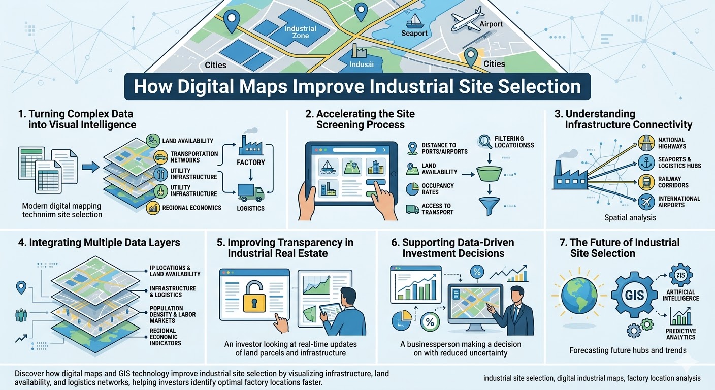
Industrial site selection is one of the most critical decisions for manufacturing investors. A factory’s location influences logistics costs, supply chain efficiency, labor accessibility, and long-term expansion potential. Traditionally, companies relied on static reports, broker recommendations, and manual research to identify suitable industrial sites.
Today, digital mapping technologies are transforming this process. By combining geographic data, infrastructure information, and industrial park datasets, digital maps provide investors with a clearer and faster way to evaluate potential locations.
1. Turning Complex Data into Visual Intelligence
Industrial investment decisions involve large volumes of data—land availability, transportation networks, utility infrastructure, and regional economic indicators. When this information is presented only in spreadsheets or documents, it becomes difficult to interpret.
Digital maps convert these datasets into visual layers of information. Investors can immediately see the spatial relationships between industrial parks, highways, seaports, airports, and nearby cities.
This visual approach makes it easier to identify strategic locations where logistics networks, industrial clusters, and infrastructure converge. Instead of analyzing isolated data points, investors can understand the geographic context of each site.
2. Accelerating the Site Screening Process
One of the biggest challenges in industrial investment is narrowing down potential locations from hundreds of possibilities. Traditional research methods often require weeks of communication with developers, government agencies, and consultants.
Digital mapping platforms significantly shorten this process. Investors can filter industrial parks based on key criteria such as:
- Distance to ports or international airports
- Industrial land availability
- Occupancy rates and expansion potential
- Access to major transportation corridors
By applying these filters directly on a map interface, companies can quickly shortlist suitable locations and focus detailed analysis on the most promising sites.
3. Understanding Infrastructure Connectivity
Infrastructure connectivity is a decisive factor in factory location decisions. Manufacturing operations depend heavily on efficient transportation networks for both raw materials and finished goods.
Digital maps allow investors to evaluate how well an industrial park connects to:
- National highway networks
- Seaports and logistics hubs
- Railway corridors
- International airports
Through spatial analysis, investors can estimate transport distances and travel times, helping them assess logistics efficiency before committing to a site.
4. Integrating Multiple Data Layers
Modern digital mapping platforms go beyond simple geographic visualization. They integrate multiple layers of industrial intelligence into a single interface.
For example, a digital map may combine:
- Industrial park locations and land availability
- Infrastructure and logistics networks
- Population density and labor markets
- Regional economic indicators
This layered approach enables investors to analyze how different factors interact across regions. It also allows them to compare industrial parks more effectively, identifying areas that offer the best balance of cost, accessibility, and growth potential.
5. Improving Transparency in Industrial Real Estate
Industrial real estate markets have historically suffered from limited transparency. Information about available land or infrastructure readiness is often scattered across different sources and may not be updated regularly.
Digital maps help address this issue by centralizing industrial data into a transparent and easily accessible format. Investors can independently explore industrial regions, verify land availability, and analyze infrastructure connectivity without relying solely on intermediaries.
Greater transparency increases investor confidence and helps create a more efficient industrial property market.
6. Supporting Data-Driven Investment Decisions
As manufacturing supply chains become more globalized and competitive, companies are placing greater emphasis on data-driven decision making. Digital maps provide a powerful analytical tool that supports this approach.
By combining spatial visualization with real-time industrial data, mapping platforms enable investors to evaluate locations based on evidence rather than assumptions. This reduces uncertainty and improves the overall success rate of factory site selection.
7. The Future of Industrial Site Selection
Digital mapping technology is rapidly evolving. Emerging tools now integrate GIS systems, artificial intelligence, and predictive analytics to forecast industrial development trends and identify future manufacturing hubs.
These innovations are turning digital maps into intelligent decision-support systems that guide investors toward the most strategic locations.
As industrial ecosystems continue to expand, digital maps will play an increasingly central role in shaping where factories are built and how industrial regions develop.
Meta Description (≈200 characters)
Keywords:
industrial site selection, digital industrial maps, factory location analysis
(1).png)