How Investors Use Maps to Shortlist Factory Locations
Learn how investors use digital maps and location intelligence to shortlist factory locations in Vietnam, reducing risk and accelerating industrial investment decisions.
How Investors Use Maps to Shortlist Factory Locations
In today’s competitive industrial landscape, selecting the right factory location can make or break a manufacturing investment. Traditional methods—relying on local contacts, printed brochures, or outdated spreadsheets—are no longer enough. Digital mapping platforms and location intelligence now empower investors to make faster, smarter, and more strategic decisions.
1. Visualizing the Industrial Landscape
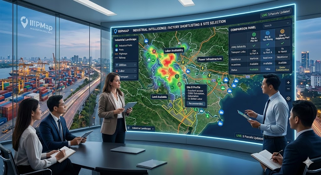
Maps transform complex data into a visual format that is easy to interpret. Investors can see industrial parks, available land parcels, infrastructure networks, and nearby suppliers all in one interface. By overlaying multiple layers of information, such as transport connectivity, utility capacity, and labor availability, maps help investors quickly identify regions that align with their operational needs.
This visual approach reduces guesswork and highlights areas with high potential while filtering out unsuitable locations. For example, a map may reveal a park with excellent road access but limited electricity capacity—information that might have been missed in traditional reports.
2. Prioritizing Locations with Real-Time Data
Static reports are often outdated by the time investors receive them. Real-time mapping platforms update occupancy, land availability, and infrastructure status continuously. Investors can instantly see which plots are available and which factories are under construction.
This immediacy allows companies to shortlist optimal locations in days instead of months, giving them a competitive edge in high-demand regions. Investors can also monitor trends over time, such as new industrial park development or infrastructure upgrades, to anticipate future opportunities.
3. Comparing Regions and Industrial Parks
Maps allow for easy comparison across multiple sites. Investors can evaluate:
- Proximity to major highways, ports, and rail networks
- Access to skilled labor pools
- Utility reliability and capacity
- Occupancy rates and potential expansion opportunities
By visualizing these factors side by side, investors can prioritize sites that balance cost, efficiency, and long-term growth potential. This reduces the risk of poor location decisions and ensures alignment with business objectives.
4. Scenario Planning and Strategic Insights
Advanced mapping tools also enable scenario analysis. Investors can model different site selections based on projected production volumes, supply chain constraints, or regional incentives. This predictive capability ensures that the shortlist not only meets current requirements but also supports future growth.
5. Integrating Maps with Broader Industrial Intelligence
Modern industrial maps are often part of a larger digital intelligence ecosystem, connecting investors with government data, infrastructure plans, and economic indicators. Platforms like IIPMap combine GIS data with real-time industrial metrics, giving investors a holistic view of opportunities across Vietnam.
This integration streamlines decision-making, reduces reliance on brokers, and enhances transparency, ultimately improving the success rate of factory location selection.
(1).png)